Take Action – Shinn Ranch map extension

Shinn Ranch location map

The Shinn Ranch project’s tentative map time extension is on the Board of Supervisors agenda for July 19, 2016 at 2:00 pm.  Many circumstances have changed since the original map was approved in 2007, and the surrounding community is asking for the map extension to be denied.  See detailed explanation below.

The County’s files are available here:
https://eldorado.legistar.com/LegislationDetail.aspx?ID=2779030&GUID=3CA822D1-377A-4B7C-B5C6-3DC8DAD0CA2A&Options&Search&FullText=1

The proposed project includes 141 single-family houses on 167 acres, which will add approximately 1,400 car trips to Mother Lode Drive daily.

Please attend the Board of Supervisors meeting to request that the map extension be denied:

Tuesday, July 19, 2016 at 2:00 pm
El Dorado County Board of Supervisors
330 Fair Lane, Building A
Placerville, CA 95667

To send in your comments via email, send to:

Supervisor Mikulaco <bosone@edcgov.us>,
Supervisor Frentzen <bostwo@edcgov.us>,
Supervisor Veerkamp <bosthree@edcgov.us>,
Supervisor Novasel <bosfive@edcgov.us>,
Supervisor Ranalli <bosfour@edcgov.us>,
Clerk of the Board <edc.cob@edcgov.us>

Subject:  Shinn Ranch, File #07-1802, Agenda Item #49

The Shinn Ranch map extension is being appealed to the Board of Supervisors based on the grounds that the project approval violates California Environmental Quality Act (CEQA), the applicable general plans and zoning laws, and that the comments submitted to the Planning Commission contained
accurate statements of significant legal violations that were not addressed by the Planning Commission at the hearing.

In addition to the legal violations not addressed previously, the following are additional facts which must be addressed regarding this time extension, approval of which indicates that these concerns should have been considered when the tentative development was approved in 2007.

1. Measure E approval (June 2016)
The approval of Measure E reinforces Measure Y, which should therefore have been applied and still applies to this project.

2. Fire safety for nearby properties-health and safety hazard
There is no water supply, fire hydrants, nor any egress on the narrow roads leading to the existing 38 homes/56 parcels on Kingvale Road, Concept Mountain Rd, Kingvale Court, and Wildcrest Road south of the planned development. This tentative development and the planned new homes increases the chances of a fire occurring. With the current plans using Kingvale road, this causes a huge bottleneck for all residents relying on Kingvale road as their only exit. The project should have mitigated the reality of fire for all the residents beyond the project on Kingvale road which have no way of protecting themselves from this hazard. The planners chose to use their only exit.

3. Indian burial sites
The local Native Miwok tribal Communities submitted the following comments to county planning: “We have serious concerns of possible burial sites that may exist and are purposely obscured. The tentative map does provide for ” … in the event of human remains are encountered … ” which would be considered inadvertent discovery. This is very different from original knowledge of same prior to any discovery during construction. This is not acceptable and disrespectful to cultural ancestors and the disturbance of any remains. There are not typically any markers with Indian burial sites, but, the area would be considered sacred and should be preserved as sanctuary. More time is needed to research and respond to this issue. The secondary problem is that excavation of these burial grounds will reintroduce Valley Fever and other ratified diseases to the surrounding community. This is a health and safety issue for the community. Apparently there is no study or plan to contain this disease once it is airborne.

4. Notification of affected properties
In 2007 when this tentative map was approved, notification was made in the newspaper, but a limited number of adjacent property owners were notified. At that time, notification was required if property was within 500 feet of the planned development. Currently, the requirement is one mile. Some residents claim they did not receive these notifications. We’re they sent certified? Tom Shinn owned 3 of the properties affected at that time, maybe more.  A full background would need to be done in order to verify. Many residents do not subscribe to the Mountain Democrat. Word of mouth is not an appropriate vehicle for notification.

5. Existing deed restrictions- Shinn Ranch Road properties
A deed restriction was attached to deeds signed by Tom Shinn and Linda Lou Fine when the Shinn Ranch Road properties were sold. These existing properties are adjacent to the tentative map. Restrictions include:
• Dwelling must be a minimum of 2600 sq. ft (exclusive of garage)
• Second dwellings not to exceed 1200 sq ft.
• No manufactured or modular dwellings except during construction
• No track or course for bikes, quads, motorcycles
• Only domestic livestock allowed (no excessively noxious or noisy animals)
Changes to these restrictions requires written consent of all adjoining property owners bordering a Shinn Ranch Road property. The 5 and 10 acre parcel owners on Shinn Ranch Road have concerns over how the tentative development is in opposition to these restrictions, especially the home square footage restriction. There are also similar deed restrictions for all properties north of old timer lane to Mother Lode. This development does not fit within the existing CC & R’s. Nor does it fit within the existing neighborhood.

6. Increased traffic Kingvale Road
Access is already difficult and dangerous at Shinn Ranch Road, Kingvale and on an already dangerous thoroughfare, Mother Lode Drive, especially when the sun glare is brightest turning west on Mother Lode off Kingvale in the late afternoon. Several have been injured or killed at Kingvale and Mother Lode Drive.  Follow up with CHP for data as it appears this was also not taken into consideration. The proposed deceleration and turn lanes added as part of this project won’t handle the added traffic. Mother Lode is a narrow two lane road. Apparently planning failed to study the impact to the existing residents already using Kingvale road. This development only makes this intersection more dangerous for the existing communities. This development should NEVER have access to Kingvale road due to the added risk, traffic and inconvenience to the existing residents who only have one way into their homes. It is also a private, maintained road by the residents of Gold Country, whom bare. the full cost of road maintenance.

7. County to pay for infrastructure?

Since the County has constructed an Animal Shelter at another location since the approval of this project, all references to the County reimbursing the developer, such as “The applicant and El Dorado County shall enter into a reimbursement agreement in the event that this development occurs prior to El Dorado County construction of the roads for the Animal Shelter,” should be removed.  The County should not be responsible for providing the infrastructure for this project. 

8.  Drainage

Much of the drainage mitigation is to be determined after approval of the project, which is a violation of CEQA.  It should have been required of the applicant to show that adequate drainage is possible with the amount of homes being proposed to ensure that the neighboring properties will not be impacted by future drainage issues.

9. Quality of life.

Noise, light and air pollution, crime. Destroys rural atmosphere we all enjoy.


Planned move for Placerville courthouse rattles Gold Rush town

Attend Dollar General Appeal Hearing – Tuesday, April 5th at 2:00pm

Please attend and show support for Main Street, Georgetown

From Georgtown Gazette, March 31, 2016, Letters to the Editor

Dollar General is a gargantuan design

To the people of the Georgetown Divide and El Dorado County, I am reaching out to you with good news, that the Dollar General project approved by our planning commissioners is not a done deal, the jury is still out.  The Georgetown Preservation Society has appealed this project directly to the Board of supervisors and consequently we have a hearing date set for Tuesday April 5th, at 2pm.

We need all the support we can get from concerned citizens who love or care about historic Georgetown.  Folks, you need to come out to this Board Meeting if we are to steer the County toward the right decision about this very important matter.  They’ve heard from some of us but not from enough of us.  There are critical issues at stake including flooding, the fate of Empire Creek and the unknown condition and extent of an underground mine. 

As concerning our cultural resources and tourism, guidelines of the General Plan that protect against the defacement of historic districts, in spite of all the commentary from the public, has been ignored by our government.. The Dollar General would be a massive structure, and if they had wanted to put it over on Highway 193 somewhere, they wouldn’t be facing this opposition.  Mr. Beam has the right to sell or develop his three parcels, but let’s keep it historical Georgetown, as all the others on Main Street have.  If we band together we can save our town.  If we don’t, this project will be the end of Georgetown as we know it.  The gargantuan design will be unlike any architecture from the California gold rush era, nor does it fit in with the Victorian structures surviving and maintained in the area until now.   As you all know they want to construct Dollar General and a great big lighted parking lot and loading dock along Main Street, between the stamp mill and the rest of the historic town, across the street from the oldest hotel.  As Jeff Worton said at a hearing, it is a spaceship landing in town.  I invite you all to join me and GPS at the April 5 hearing to shut this irreversible act of defacement down.

DAVE SOUZA

Meeting Location:
Board of Supervisors
Building A
330 Fair Lane, Placerville, CA

Take Action – Dollar General in Georgetown

Folks in Georgetown:

Want to stop the Dollar General project?

Dollar General Northwest elevation
View from Main Street

The most efficient way to stop this project is to ask Supervisor Ranalli to do an emergency measure to implement a Historic District overlay for Main Street, Georgetown:  bosfour@edcgov.us or 530-621-6513.

Historic Design General PoliciesHistoric Design Conforming Structures Historic Design Commercial page 1Historic Design Commercial page 2Otherwise, your only options are to hold the Planning Commission to the design standards of a Design Community overlay, or to not combine the three parcels.

The three parcels have a Design Community (DC) overlay.

Dollar General parcel Design Control
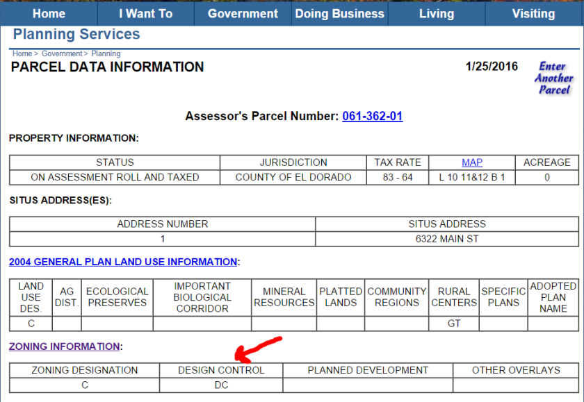
Because the parcels are zoned commercial you can’t really fight the commercial use, but you can challenge health and safety issues, such as water, sewer, transportation, drainage, etc.  and challenge the look of the buildings based on the following DC development codes:

Sec. 130.74.020. – Purpose.

  1. For the protection, enhancement and use of places, sites, buildings and structures having special character, aesthetic interest and value;
  2. Enhancement of tourism and the economy of the County by protecting and preserving places having special and unique character and interest.

Sec. 130.74.030. – Creation of districts.

The Board of Supervisors, following consideration by the Planning Commission, may create new design review districts. When creating a new design review district, the Board of Supervisors shall find that the area proposed is:

  1. An area of special, natural beauty and aesthetic interest forming a basic resource in the economy of the County; the preservation of which would enhance the character of the County and local communities and promote tourist attractions; or
  2. Areas, places, sites, structures or uses which have special historical significance as identified by an agency representing Federal, State or local historical concerns; or
  3. Both Subsections 1 and 2 of this section.

Sec. 130.74.040. – Sierra design and community design review districts; restrictions.

  1. Any district created pursuant to Section 130.74.030.1 shall be designated on zoning maps as either design Sierra (-DS) or as design community (-DC) as the case may be.
  2. All new commercial within the boundaries of a community design district shall conform in exterior styling to that style of architecture described in Subsection C of this section. Approval for compliance with design criteria shall be provided for in Section 130.74.115.

C.The architectural styling for new construction permitted in the community design districts shall be that which is exemplified and meets the intent of the community design guide which shall be adopted by the Board of Supervisors. These design guides shall provide guidelines and examples for architectural styles and site design permitted in the subject districts.

Full Code:

https://www.municode.com/library/ca/el_dorado_county/codes/code_of_ordinances?searchRequest=%7B%22searchText%22:%22design%20control%22,%22pageNum%22:1,%22resultsPerPage%22:25,%22booleanSearch%22:false,%22stemming%22:true,%22fuzzy%22:false,%22synonym%22:false,%22contentTypes%22:%5B%22CODES%22%5D,%22productIds%22:%5B%5D%7D&nodeId=PTBLADECO_TIT130ZO_CH130.74DEREDI_S130.74.115AP

Aerial photo of site
Photo showing the three parcels proposed for combining to create the project site
Site Plan
Footprint of the project on the three parcels

LINKS TO CORPORATE AND SUBSIDY INFORMATION REGARDING DOLLAR GENERAL:

http://corp-research.org/dollar-general

http://subsidytracker.goodjobsfirst.org/prog.php?parent=dollar-general

http://violationtracker.goodjobsfirst.org/prog.php?parent=dollar-general

Link to County website for Dollar General project:

http://edcapps.edcgov.us/Planning/ProjectInquiryDisplay.asp?ProjectID=20215


COURT RULES AGAINST EL DORADO COUNTY BOARD OF SUPERVISORS

For Immediate Release

Contact: Sue Taylor (530) 391-2190

COURT RULES AGAINST EL DORADO COUNTY BOARD OF SUPERVISORS

December 23, 2015, Cameron Park, CA
The El Dorado Hills Town Center Apartments project approval has been overturned by the courts, one year after its approval by the Board of Supervisors. The court ruling substantiates the public’s claims that the El Dorado County Board of Supervisors abused its discretionary authority when it ignored the El Dorado Hills Specific Plan, the El Dorado Hills Area Planning Advisory Committee, and the El Dorado County Planning Commission, in addition to violating the County’s general plan, density limits, design standards, and the requirement to mitigate impacts to infrastructure in approving the Town Center Apartments project on December 2, 2014.

The following is an excerpt from the ruling handed down December 18, 2015 by the El Dorado County Superior Court on the matter of Citizens for Sensible Development in El Dorado Hills v County of El Dorado:

“As explained in detail below, the Court finds the administrative record contains substantial evidence that the proposed project might have significant environmental impact that requires further review. The Court finds that the project at issue is a new project, not a modified one and that substantial evidence exists to support a fair argument of significant traffic environmental impacts due to the project, despite existing or planned mitigation. The Court also finds that in approving the project, Respondent has not proceeded as required by law under CEQA.”

The documents and other related information are available here: https://saveourcounty.net/el-dorado-hills-town-center-apartments/

Camino resident Sue Taylor further explained, “Continuing their abuse of discretionary authority, the Board of Supervisors proceeded in a similar action on December 15, 2015 to approve the General Plan and Zoning Ordinance Update (TGPA/ZOU). Just like the Board’s action on the Town Center Apartment project, this General Plan and Zoning Ordinance overhaul forces the public to file a lawsuit against the County in order to protect the county’s resources, the voter-approved General Plan, and historic zoning rights. This end-of-the-year action will have an enormous negative impact on the rural nature of El Dorado County.”

“It is just one more example of why we need better representation on the Board of Supervisors,” added Rescue resident Ellen Van Dyke. “Supervisor Mikulaco voted along with Supervisor Veerkamp to approve the Town Center Apartments project last year, ignoring his District 1 constituents’ opposition to the project. The same pattern of disregard and reckless disdain of public input was exhibited by four of the five Supervisors in the recent vote to pass the General Plan and Zoning Ordinance overhaul, in spite of all the flaws pointed out by County residents.”

Shingle Springs resident Lori Parlin stated, “It was almost like déjà vu to see four out of five Supervisors vote to ignore environmental law – again. El Dorado County residents can no longer ignore the clear pattern set by the Supervisors. It is time for voters to take action and replace the current Supervisors with public servants that will represent our County as they promised rather than advocate for special interests.”
============/////////////\\\\\\\\\\\\============